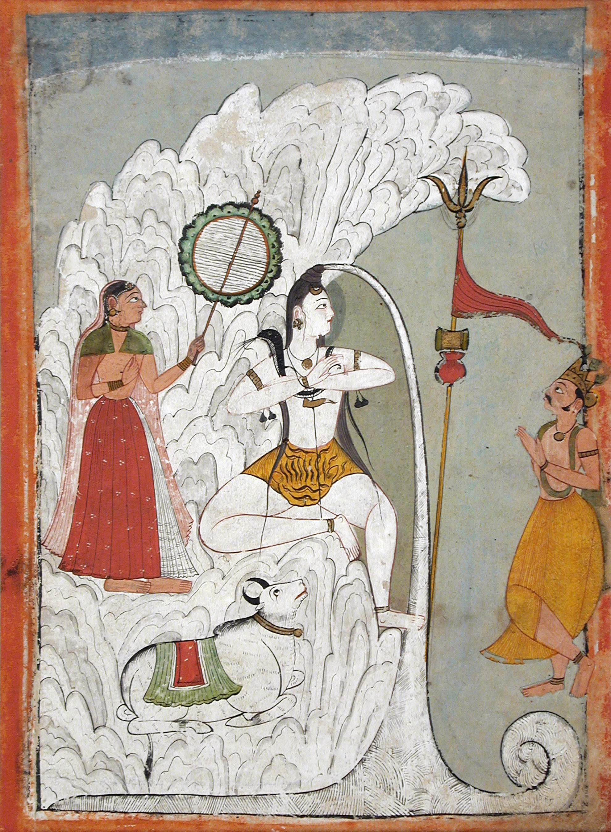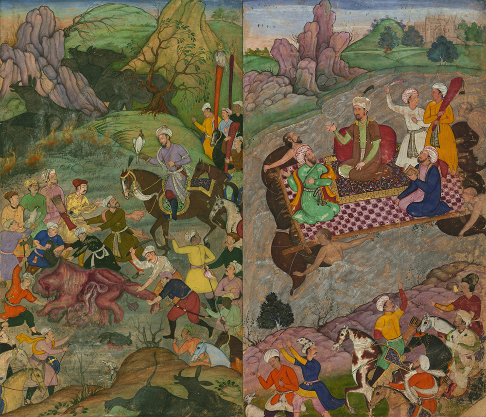
Shiva Bearing the Descent of the Ganges River, folio from a Hindi manuscript by the saint Narayan, c. 1740. Los Angeles County Museum of Art, Gift of Paul F. Walter.
Given their immense power both to sustain and to destroy life, India’s rivers have been among the most revered on Earth. The river Ganges—often styled as “mother,” or “Ma Ganga”—is the archetypical sacred river, spiritual source of all of India’s rivers, writes scholar of Hinduism Diana Eck. In some sense, all of India’s other rivers are microcosms of the Ganges. For millennia, the Ganges has been a site of pilgrimage, most especially at the point of its confluence with the Yamuna River at Prayag. For many Hindus, moksha—liberation from the cycle of rebirth—has been believed to come from bathing in the waters of the Ganges, or being cremated on its banks. The purity of the waters of the Ganges (gangajal) has long been accepted and valued by people across India. Hindu scriptures contain many versions of the origin myth of the Ganges, known as the avatarana, or descent to Earth. In the version of the story in the Ramayana and the Mahabharata, the unruly Ganges tumbles from heaven, tamed as it flows through the serpentine locks of Shiva’s hair before it spills onto the plains of India. In all of these stories, the Ganges epitomizes liquid shakthi, the energy that sustains the universe. The Ganges is not alone, it stands at the apex of a land of sacred waters. In many regions of India, rivers have been personified; their flow helps people to imagine how distant places are connected to one another. In many spiritual traditions in South Asia, the rivers have been thought to channel the power of all the water in the world, from the clouds to the oceans.
Over centuries India’s rulers built irrigation canals, storage tanks, channels, and dams. Regional leaders and imperial administrations spearheaded construction projects, but so too did local lineages, temple complexes, and landowners. In the premodern period the most widespread infrastructures of irrigation were found in Sri Lanka and in central and southern India. The biggest of them were elaborate hydraulic systems, individual waterworks linked in a larger web. And some of the dams, like the sixteenth-century Daroji reservoir in arid northern Karnataka, were large even by modern standards. Spurts of hydraulic ambition alternated with stasis, construction with disrepair. The power that arose from the control of water spread unevenly, liable to seizure or decay.
Water was never far from the minds of the mounted conquerors from the highlands of Inner Asia who stormed their way to the Gangetic plain in the second millennium to forge a new political power in India. The heart of their power lay at the frontier between the monsoon and the arid lands. They harnessed the benefits of both. Established in 1206, the Delhi Sultanate was the first Persian-Islamic state in South Asia. Though it collapsed in the second half of the 1300s, riven by internal division and threatened by fresh invasions from the northwest, the reach of the sultanate’s power into the heartland of the Indian subcontinent was a prelude to the Mughals’ even greater empire.

The Mughals were a Turko-Mongol dynasty with roots in present-day Uzbekistan. They unified much of the Indian subcontinent during the two centuries when they were at the height of their powers. Zahir-ud-din Muhammad Babar (1483–1530), known as Babur, was the first Mughal emperor. He claimed descent from Timur (Tamerlane), the Turkic conqueror, and on his mother’s side from Chingghis Khan. Driven from Samarkand, Babur established a new kingdom in Kabul, Afghanistan. From there he launched an assault on the Indian subcontinent, where he established the Mughal Empire in 1526. From the age of twelve, he kept a diary from which he later composed the Babur Nama, one of the earliest autobiographies in the Islamic tradition. He was a meticulous observer. He was driven by naked ambition. He was not averse to brutality. He was a lover of nature. The Babur Nama is filled with references to water. Babur’s primary interest was in water as both ornament and practical necessity in constructing the gardens that he loved. In the Mughal tradition of landscape architecture, gardens played both a symbolic and an aesthetic role: they were places of beauty and sensual pleasure. Their proportions embodied the principles of order and harmony.
Babur’s interest in water went beyond the requirements of his exquisite gardens. He commented on the entire system of irrigation at work as he advanced into North India. The cultivation of gardens and the sustenance of agriculture were related endeavors. “The greater part of the Hindustani country is flat,” he observed of the Yamuna valley. “Many though its towns and cultivated lands are, it nowhere has running waters”—by “running waters,” Babur meant the canals well known in the Central Asian lands of his birth. Rather, “rivers and, in some places, stagnant waters” in wells or tanks, irrigated the Indian plains. He saw that “autumn crops grow by the downpour of rain themselves,” but that “some vegetables” had to be “watered constantly.” Babur observed cultivators at work. He was struck particularly by the method that the British would later dub the Persian Wheel. “In Lahore, Dibalpur and those parts people water by means of a wheel,” he wrote:
They make two circles of ropes long enough to suit the depth of the well, fix strips of wood between them, and on these fasten pitchers. The ropes with the wood and attached pitchers are put over the well-wheel. At one end of the wheel axle a second wheel is fixed, and close to it another on an upright axle. This last wheel the bullock turns. Its teeth catch in the teeth of the second, and thus the wheel with the pitchers is turned. A trough is set where the water empties from the pitchers and from this the water is conveyed everywhere.
Further down the Yamuna valley, toward Agra, he noticed that “people water with a bucket”—leather buckets lifted by yoked oxen—which he described as “a laborious and filthy way.”
The Mughal realm expanded ceaselessly between 1560 and 1605, and again between 1630 and 1690. Its territories stretched from Gujarat in the west to Bengal in the east, and far into South India. The Mughals mobilized long-distance trading networks that followed the caravan routes to the western edge of central Asia and beyond. They stored wealth in precious metals. Once the Mughals conquered the Gangetic plains, they filled the state’s coffers from productive, densely settled agrarian lands and large populations. The Mughals inaugurated a rigorous system of land taxation. The administration relied on an interlocking system of larger landowners (zamindars), who served as tax collectors, and, below them, subordinate holders of rights to the land. The state used land grants to reward its loyal officials and to co-opt local elites into the system.

Mughal military and financial prowess came from the mounted martial traditions of dry lands. As many as one in five men served in local military forces, often as seasonal labor in a climate where agriculture was uncertain and horses were plentiful. But India’s unruly waters had a bearing on Mughal military strategy, as they would later constrain the options of the British. As they approached the Bengal delta, Mughal armies struggled beyond Rajmahal—their horses were ineffective in the humid conditions; they had to use boats. The Akbar Nama, Abul Fazl’s account of the Emperor Akbar’s reign (1556–1603), describes the challenge of climate. In 1574, as Akbar’s forces captured the city of Patna—near the site of the ancient Ganges River port of Pataliputra—they “chose the river route, in this season full of turbulence, and with constant rain and tempest.”
Aside from military campaigns, the instability of India’s rivers were a source of woe to local inhabitants. Historian Irfan Habib’s An Atlas of the Mughal Empire—a painstaking work of recovery—pieced together, from the minutiae of Persian sources and European travel accounts, how often, how abruptly, rivers changed course. This turmoil came from the huge loads of silt the rivers carried down from the Himalayas—when the rivers were in full force they threw up sandbanks and islands as obstacles around which the waters found a new path; silt deposits raised riverbeds and pushed the rivers into new channels. At other times, sudden changes in course were driven by violent earthquakes. The only response was flight—abandoned settlements lined the banks of vanished rivers, as when the Ganges “deserted” the once-flourishing town of Kanauj in the early sixteenth century. People had no choice but to move with the migrating waters. Beginning in the early seventeenth century, the Ganges began to shift eastward. A major earthquake in 1762 and another in 1769–1770 jolted the river away from its channel, forcing it into contact with new tributaries: the Tista and the Jamuna, the Jelangi and the Mathabhanga, the Kirtinasa and the Naya Bhangini. Even the names that rivers bore could be a testament to their instability: “Naya” means new, suggesting memories of an old Bhangini. The coastline shifted with the rivers: Habib reconstructs the coast of Gujarat through “decaying ports”: places that had once been on the coast, that now lay silted up.
As their realm expanded to reach India’s coasts, the Mughals incorporated within their realm port towns that faced the eastern and western Indian Ocean. Long before the arrival of Europeans, merchants in India had trading links that spanned the Indian Ocean rim. Indian textiles filled marketplaces across Southeast Asia and China, the Mediterranean and West Africa. Many regions of India—Gujarat, Bengal, and the Coromandel coast—thrived on long-distance trade. Textiles brought forth medicinal products, spices, local crafts, and large quantities of precious metals. On one estimate the Indian economy absorbed 20 percent of the world’s supply of silver between 1600 and 1800. Throughout Southeast Asia’s era of commercial expansion in the sixteenth century, Indian traders from the coasts of Gujarat, Madras, and Bengal shipped cloth to Pegu and Tennasserim in Burma, to the thriving port of Melaka on the Malay peninsula, and to the Indonesian islands of Sumatra and Java.

The Portuguese apothecary Tomé Pires observed in Melaka in 1512 that ships from Bengal brought “five white cloths, seven kinds of sinabafos, three kinds of chautares, beatilhas, beirames, and other rich materials. They will bring as many as twenty kinds.” In their holds came “very rich bed-canopies, with cut-cloth work in all colors and very beautiful,” and “wall hangings like tapestry.” Pires concluded that “Bengali cloth fetches a high price in Melaka, because it is a merchandise all over the east”—from Melaka these textiles would make their way to markets across the Indonesian archipelago. In return, Indian traders exported from Melaka “camphor and pepper—an abundance of these two—cloves, mace, nutmeg, sandalwood, silk, seed-pearls a large quantity, copper, tin, lead, quicksilver, large green porcelain ware from the Liukiu [Japan’s Ryukyu islands], opium from Aden…white and green damasks, enrolados from China, caps of scarlet-in grain and carpets; krises and swords from Java are also appreciated.” The variety of Indian cloth gave rise to a lexicon that seeped into languages of trade everywhere: longcloth and salemporis, moris and gingham, dungarees and guinea cloth and kaingulong. Indian weavers targeted diverse markets. Their weaves, patterns, colors, and designs were all adapted to local tastes.
The Indian Ocean’s trading world reached deep into the interior. It intersected with circuits of commercial exchange that went overland to Central Asia. In India, as elsewhere, the sixteenth and seventeenth centuries saw the deepening commercialization of the countryside. From 1500, South India saw the rise of a merchant class whose diversified business included overseas trade, collecting and keeping a share of local tax revenues, and financing local rulers’ military ambitions. Global demand for Indian cotton set up a chain of transactions that linked the cotton-growing countryside to the port towns. Cultivators became more dependent on credit from urban merchants to finance the next year’s crop; gold and silver currency came into more widespread use. Agrarian commercialization fed the Mughal state’s treasury. The state’s demand for cash taxes, historian Victor Lieberman observes, “acted like a giant pump, sucking foodstuffs from the countryside into towns and cities.”
Adapted from Unruly Waters: How Rains, Rivers, Coasts, and Seas Have Shaped Asia’s History by Sunil Amrith. Excerpted with permission from Basic Books, an imprint of Hachette Book Group. Copyright © 2018 by Sunil Amrith.
